PROVISIONAL DATA SUBJECT TO REVISION
Click to hidestation-specific text
Funding for this site is provided by:
 Site Information
LOCATION.--Lat 42°11'38.2", long
75°51'12.0" referenced to North American Datum of
1983, Broome County, NY, Hydrologic Unit 02050102, at end of
Jeffery Drive on Chenango Forks School District property at
Kattelville.
WELL CHARACTERISTICS.--Depth 47 ft. Upper casing diameter 6 in; top of first opening 48.5 ft, bottom of last opening 50.9 ft. Well filled in from original depth of 53 ft, cased to 53 ft (screen, 48.5 ft to 50.9 ft). Elevation of land-surface datum is 908.58 ft above NGVD of 1929 and 908.13 ft above NAVD of 1988.
DATUM.--Land-surface datum is 908.13 ft above North American Vertical Datum of 1988. Measuring point: Top of shelter shelf, 3.57 ft above land-surface datum, Apr. 4, 2012 to present.
PERIOD OF RECORD.--September 1980 to August 1995 and October 2002 to current year. Records for September 1980 to February 1982 are unpublished and are available in files of the U.S. Geological Survey.
GAGE.--Water-stage recorder--15 minute; periodic measurements by USGS personnel.
REMARKS.--Water level may be affected by nearby pumping. Satellite water-level telemeter at station.
EXTREMES FOR PERIOD OF RECORD.--Highest water level, 14.08 ft below land-surface datum, Sep. 9, 10, 2011; lowest measured, 33.05 ft below land-surface datum, Dec. 19, 2001.
 WaterAlert – get an
email or text (SMS) alert based on your chosen threshold.
WaterAlert – get an
email or text (SMS) alert based on your chosen threshold.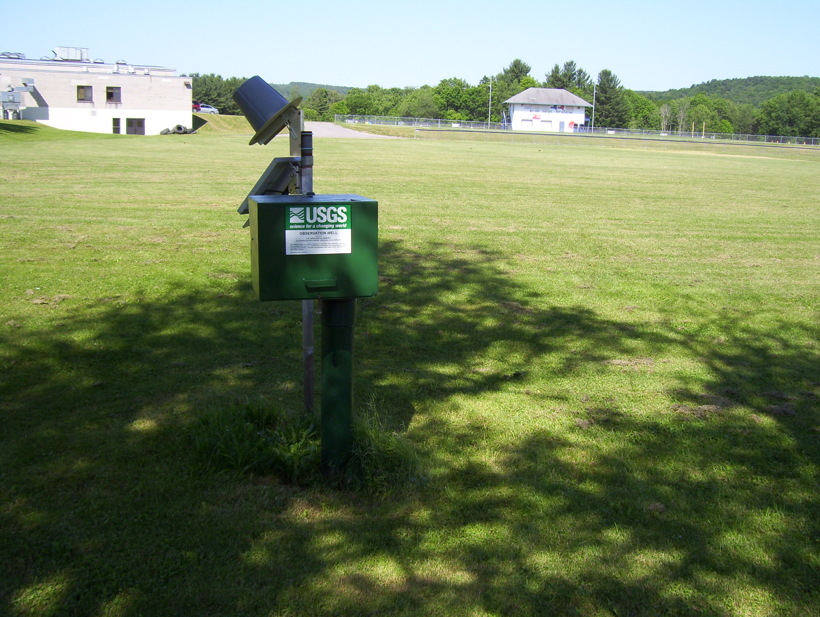 Station image
Summary of all available data for this site
Instantaneous-data availability statement
