PROVISIONAL DATA SUBJECT TO REVISION
Click to hidestation-specific text
Funding for this site is provided by:
THIS SITE DOES NOT USE SATELLITE TELEMETRY AND THEREFORE THE DATA WILL ONLY BE UPDATED ABOUT EVERY 8 WEEKS.
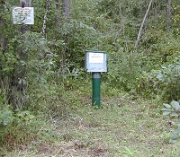 STATION.--404518077575501 CENTRE COUNTY, local well
number CE 118.
STATION.--404518077575501 CENTRE COUNTY, local well
number CE 118.LOCATION.--Lat 40`45'19.6", long 77`57'58.5", Centre County, Hydrologic Unit 02050204, at State Game Land No. 176, and near Fairbrook.
WELL CHARACTERISTICS.--Well depth 130 ft.Drilled observation well, cased to 40 ft, open hole.
INSTRUMENTATION.--Electronic data logger with 60-minute recording interval.
DATUM.--Land-surface datum is 1,146 ft above National Geodetic Vertical Datum of 1929. Measuring point: top of instrument shelf, 2.95 ft above land-surface datum, Dec. 12, 2007, to present. Elevation of land surface is from Lidar.
REMARKS.--Daily minimum and mean water levels, since June 1999, are also available from the USGS Pennsylvania Water Science Center.
PERIOD OF RECORD.--January 1968 to June 1981, July 1984 to current year.
COOPERATION.--Funding for the operation of this station is provided by the Pennsylvania Department of Environmental Protection and the U.S. Geological Survey.
Summary of all available data for this site
Instantaneous-data availability statement
