PROVISIONAL DATA SUBJECT TO REVISION
Click to hidestation-specific text
Funding for this site is provided by:
 STATION.--413346075421301 LACKAWANNA COUNTY, local
well number LK 508.
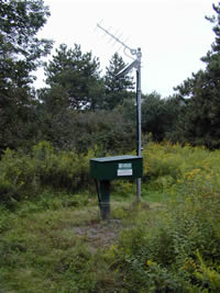
STATION.--413346075421301 LACKAWANNA COUNTY, local
well number LK 508.LOCATION.--Lat 41`33'46.5", long 75`42'13.4", Hydrologic Unit 02050106, at Lackawanna State Park, near Dalton.
OWNER.--U.S. Geological Survey.
WELL CHARACTERISTICS.--Drilled observation well, diameter 6 in., depth 202 ft, cased to 90 ft, open hole.
INSTRUMENTATION.--Data collection platform with 60-minute recording interval. Satellite telemetry at station.
DATUM.--Elevation of land surface is 1,071 ft above North American Vertical Datum of 1988, from Lidar. Measuring point: Top of casing, 3.82 ft above land-surface datum. Prior to September 8, 2022, the measuring point was 3.84 ft above land-surface datum.
PERIOD OF RECORD.--September 2001 to current year.
COOPERATION.--Funding for the operation of this station is provided by the Pennsylvania Department of Environmental Protection and the U.S. Geological Survey.
Summary of all available data for this site
Instantaneous-data availability statement