PROVISIONAL DATA SUBJECT TO REVISION
Click to hidestation-specific text
Funding for this site is provided by:
 STATION.--410727076402901 MONTOUR COUNTY, local well
number MT 258.
STATION.--410727076402901 MONTOUR COUNTY, local well
number MT 258.LOCATION.--Lat 41`07'26.9", long 76`40'28.6", Hydrologic Unit 02050206.
OWNER.--U.S. Geological Survey.
AQUIFER.--Hamilton Formation, Devonian age.
WELL CHARACTERISTICS.--Drilled observation well, diameter 6 in depth 203 ft, cased to 17 ft, open hole.
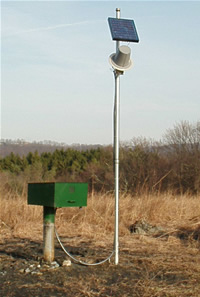
INSTRUMENTATION.--Data collection platform with 60-minute recording interval. Satellite telemetry at station.
DATUM.--Elevation of land surface is 773 ft above North American Vertical Datum of 1988, from Lidar.
PERIOD OF RECORD.--December 2007 to current year.
COOPERATION.--Funding for the operation of this station is provided by the Pennsylvania Department of Environmental Protection and the U.S. Geological Survey.
Summary of all available data for this site
Instantaneous-data availability statement