PROVISIONAL DATA SUBJECT TO REVISION
Click to hidestation-specific text
Funding for this site is provided by:
 STATION.--404140077354001 MIFFLIN COUNTY, local well
number MF344
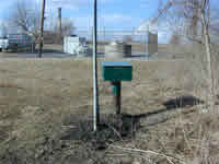
STATION.--404140077354001 MIFFLIN COUNTY, local well
number MF344LOCATION.--Lat 40 41'41.2", long 77 35'38.2", Hydrologic Unit 02050304, at Roseann.
OWNER.--Privately owned.
AQUIFER.--Bellefonte Formation, Early-Middle Ordovician age.
WELL CHARACTERISTICS.--Drilled observation well, diameter 6 in, depth 200 ft, cased to 42 ft, open hole.
INSTRUMENTATION.--Data collection platform with 15-minute recording interval since April 2023; prior, 60-minute recording interval. Satellite telemetry at station.
DATUM.--Elevation of land surface is 804 ft above North American Vertical Datum of 1988, from Lidar. Measuring point: Top of shelter platform, 2.92 ft above land-surface datum.
REMARKS.--Daily maximum, minimum, and mean water levels are available from the District Office.
PERIOD OF RECORD.--September 1983 to current year.
COOPERATION.--Funding for the operation of this station is provided by the Pennsylvania Department of Environmental Protection and the U.S. Geological Survey.
Summary of all available data for this site
Instantaneous-data availability statement