PROVISIONAL DATA SUBJECT TO REVISION
Click to hidestation-specific text
Funding for this site is provided by:
 STATION.--402411077374801 JUNIATA COUNTY, local well
number JU 351
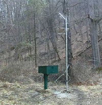
STATION.--402411077374801 JUNIATA COUNTY, local well
number JU 351LOCATION.--Lat 40 24'10.9", long 77 37'47.6", Hydrologic Unit 02050304, at State Game Land No. 215, and near Reeds Gap.
OWNER.--U.S. Geological Survey.
AQUIFER.--Brailler and Harrell Formations, undivided, Late Devonian age.
WELL CHARACTERISTICS.--Drilled observation well, diameter 6 in., depth 110 ft, cased to 20 ft, open hole.
INSTRUMENTATION.--Data Collection Platform with 1-minute recording interval since December 14, 2016; prior recording interval was 60-minute. Satellite telemetry at station.
DATUM.--Elevation of land surface is 638 ft above North American Vertical Datum of 1988, from Lidar. Measuring point: Top of metal cover, 3.55 ft above land-surface datum.
REMARKS.--This well shows significant response to Earth tides.
Daily maximum, minimum, and mean water levels since June 1999 are available from the District Office.
PERIOD OF RECORD.--June 1968 to current year.
COOPERATION.--Funding for the operation of this station is provided by the Pennsylvania Department of Environmental Protection and the U.S. Geological Survey.
Summary of all available data for this site
Instantaneous-data availability statement