PROVISIONAL DATA SUBJECT TO REVISION
Click to hidestation-specific text
Funding for this site is provided by:
 STATION.--401637076071501 LANCASTER COUNTY, local
well number LN 1351.
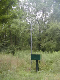
STATION.--401637076071501 LANCASTER COUNTY, local
well number LN 1351.LOCATION.--Lat 40`16'37.3", long 76`07'14.4", Hydrologic Unit 02050306, at State Game Lands 220, near Blainsport.
OWNER.--Pennsylvania Game Commission.
AQUIFER.--Hammer Creek Formation, Triassic age.
WELL CHARACTERISTICS.--Drilled unused well, diameter 6 in., depth 132 ft, cased to 50 ft.
INSTRUMENTATION.--Data collection platform with 60-minute recording interval. Satellite telemetry at station.
DATUM.--Elevation of land surface is 491 ft above North American Vertical Datum of 1988, from Lidar. Measuring point: Top of casing, 2.89 ft above land-surface datum.
REMARKS.--Daily maximum, minimum, and mean water levels are available from the District Office.
PERIOD OF RECORD.--March 2001 to current year.
COOPERATION.--Funding for the operation of this station is provided by the Pennsylvania Department of Environmental Protection and the U.S. Geological Survey.
Summary of all available data for this site
Instantaneous-data availability statement