LOCATION.--Lat 43°32'57.9", long
73°44'02.3" referenced to North American Datum of
1983, Warren County, NY, Hydrologic Unit 02020001, near
Bolton.
WELL CHARACTERISTICS.--Depth 231 ft. Upper casing
diameter 6 in; top of first opening 65 ft, bottom of last
opening 178 ft. Cased to 65 ft, open hole.
DATUM.--Land-surface datum is 772.81 ft above North
American Vertical Datum of 1988. Measuring point: Top of
casing, 1.4 ft above land-surface datum, Oct. 11, 2007 to
present; Top of shelter shelf, 3.3 ft above land-surface datum,
Oct. 1, 2016 to May. 25, 2022; Top of shelter shelf, 3.29 ft
above land-surface datum, May. 25, 2022 to present.
PERIOD OF RECORD.--November 2007 to current year.
GAGE.--Water-stage recorder--15 minute; periodic manual
measurements by USGS personnel. March to July 2008, tape
measurements by USGS personnel.
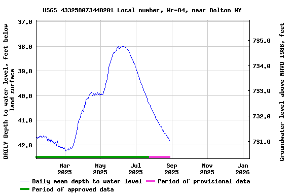
EXTREMES FOR PERIOD OF RECORD.--Highest water level,
31.51 ft below land-surface datum, May 2, 2011; lowest water
level, 43.53 ft below land-surface datum, Nov. 18, 24,
2020.
 Site Information
 WaterAlert – get an
email or text (SMS) alert based on your chosen threshold.
WaterAlert – get an
email or text (SMS) alert based on your chosen threshold.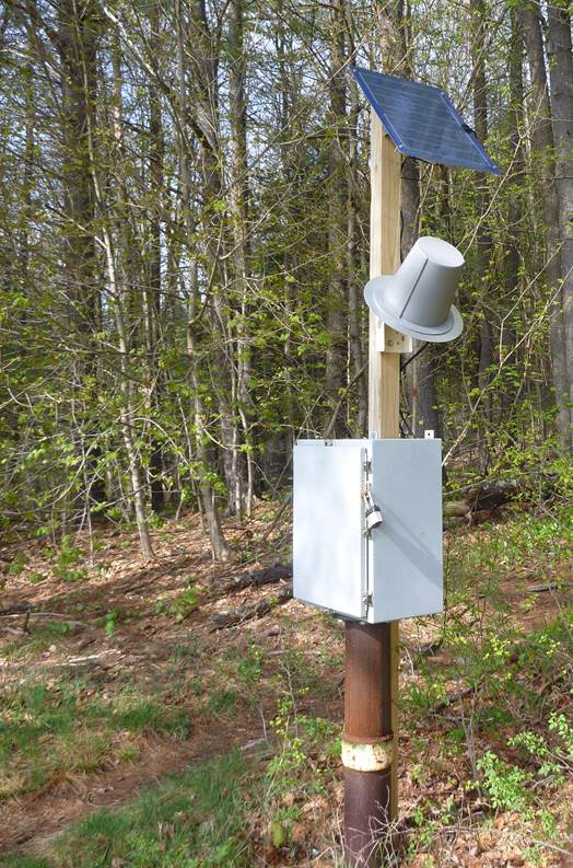 Station image