LOCATION.--Lat 43°01'46.7", long
78°10'13.6" referenced to North American Datum of
1983, Genesee County, NY, Hydrologic Unit 04120104, in State
Police air enforcement parking lot, near Batavia.
WELL CHARACTERISTICS.--Depth 74.6 ft. Upper casing
diameter 6 in; top of first opening 27.5 ft, bottom of last
opening 73 ft. Cased to 27 ft, open hole.
DATUM.--Land-surface datum is 906.23 ft above North
American Vertical Datum of 1988. Measuring point: Top of
shelter shelf, 4.13 ft above land-surface datum, Jun. 10, 2014
to present.
PERIOD OF RECORD.--September 2007 to current year.
GAGE.--Water-stage recorder--15 minute; periodic
measurements by USGS personnel.
REMARKS.--Water levels were below transducer on many
days in 2012 and 2013; record not used. Satellite water-level
telemeter at station.
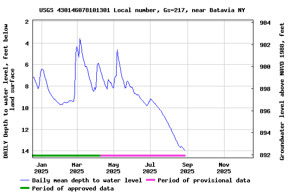
EXTREMES FOR PERIOD OF RECORD.--Highest water level,
1.20 ft below land-surface datum, Mar. 11, 2011; lowest water
level, 15.91 ft below land-surface datum, Aug. 10, 2016.
 Site Information
 WaterAlert – get an
email or text (SMS) alert based on your chosen threshold.
WaterAlert – get an
email or text (SMS) alert based on your chosen threshold.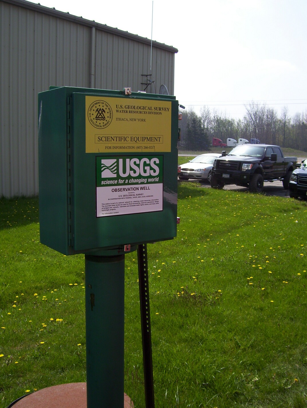 Station image