LOCATION.--Lat 42°58'21.0", long
76°46'13.2" referenced to North American Datum of
1983, Seneca County, NY, Hydrologic Unit 04140201, 1.7 miles
north of intersection of Rte 20 and 89 on Rte 89 behind hunter
check-in station.
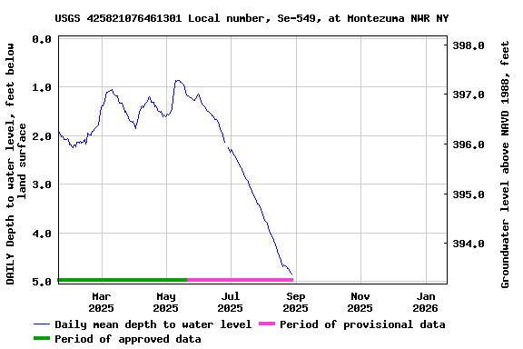
WELL CHARACTERISTICS.--Depth 33.8 ft. Upper casing
diameter 2 in; top of first opening 26 ft, bottom of last
opening 32 ft. Cased to 26 ft (screen 26 ft to 32 ft).
DATUM.--Land-surface datum is 398.18 ft above North
American Vertical Datum of 1988. Measuring point: Top of
shelter shelf, 2.73 ft above land-surface datum, Jul. 14, 2016
to Jun. 21, 2017; Top of shelter shelf, 2.72 ft above
land-surface datum, Jun. 21, 2017 to present.
PERIOD OF RECORD.--December 2014 to current year.
GAGE.--Water-stage recorder--15 minute; periodic
measurements by USGS personnel.
REMARKS.--Satellite water-level telemeter at
station.
EXTREMES FOR PERIOD OF RECORD.--Highest water level,
0.17 ft below land-surface datum, Apr. 9, 10, 2017; lowest
water level, 6.19 ft below land-surface datum, Oct. 18,
2020.
 Site Information
 WaterAlert – get an
email or text (SMS) alert based on your chosen threshold.
WaterAlert – get an
email or text (SMS) alert based on your chosen threshold.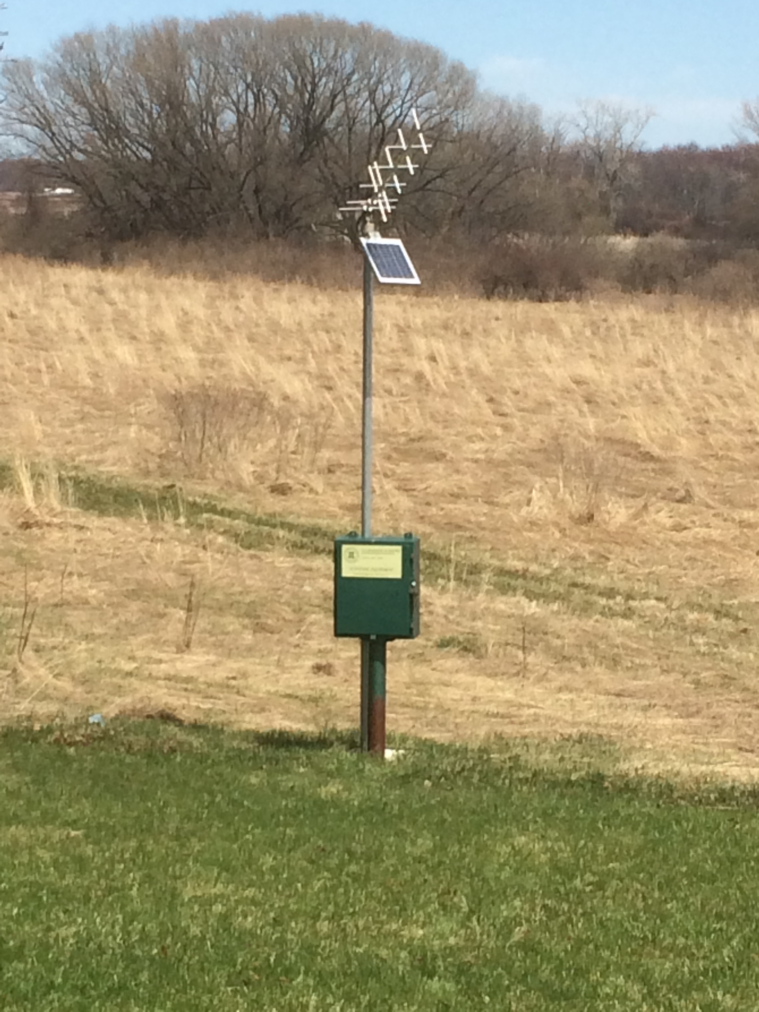 Station image