PROVISIONAL DATA SUBJECT TO REVISION
Click to hidestation-specific text
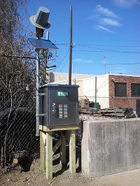
 STATION.--014755456 NAYLOR CREEK AT UPPER DARBY,
PA
STATION.--014755456 NAYLOR CREEK AT UPPER DARBY,
PALOCATION.--Lat 39`57'57.12", long 75`17'47.39", Delaware County, Hydrologic Unit 02040202, upstream side of Manor Road bridge, 600 ft southwest from Lansdowne Avenue, and 1.0 mi southwest of Philadelphia, PA.
DRAINAGE AREA.--1.70 square miles.
PERIOD OF RECORD.--March 2012 to current year.
GAGE.--Water-stage recorder. Datum of gage is 189 ft above North American Vertical Datum of 1988.
COOPERATION.--Funding for the operation of this station is provided by the U.S. Geological Survey and the Upper Darby Township Municipal Authority.
REMARKS.--Satellite telemetry at station.
Summary of all available data for this site
Instantaneous-data availability statement
