LOCATION.--Lat 42°58'32.9", long
77°50'38.7" referenced to North American Datum of
1983, Livingston County, NY, Hydrologic Unit 04130003, adjacent
to Iroquois Road, on the Caledonia Country Club, at
Caledonia.
WELL CHARACTERISTICS.--Depth 25.5 ft. Upper casing
diameter 2 in; top of first opening 29.5 ft, bottom of last
opening 31.5 ft. Well has filled in from original depth of 31.5
ft (screen, 29.5 ft to 31.5 ft).
DATUM.--Land-surface datum is 645.98 ft above North
American Vertical Datum of 1988. Measuring point: Top of
shelter shelf, 2.93 ft above land-surface datum, Aug. 1, 2012
to present.
PERIOD OF RECORD.--March 2004 to current year.
GAGE.--Water-stage recorder--15 minute; periodic
measurements by USGS personnel.
REMARKS.--Satellite water-level telemeter at
station.
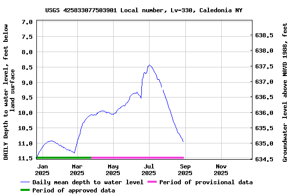
EXTREMES FOR PERIOD OF RECORD.--Highest water level,
5.54 ft below land-surface datum, May 11, 2017; lowest
water level, 13.87 ft below land-surface datum, Nov. 19,
2007.
 Site Information
 WaterAlert – get an
email or text (SMS) alert based on your chosen threshold.
WaterAlert – get an
email or text (SMS) alert based on your chosen threshold.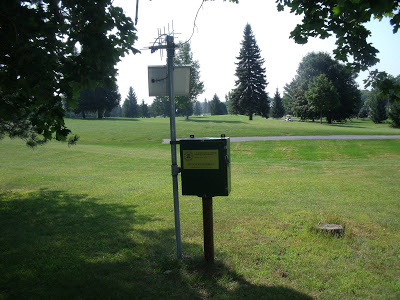 Station image